
The basic core of this itinerary is what remains on natural ground, not incorporated into the current SP254 Meana-Pian del Frais, of the nineteenth-century Military Road Meana Di Susa-Madonna Della Losa – Serre d’Arnoud – Gran Serin which was 20.5 km long and overcame a total elevation gain of more than 1,800 m. With an average slope of 9%. And it was the main route for troops to reach the batteries of the Gran Serin, the defensive key of the “Assietta system.”
The dirt road-which is entirely in Chiomonte territory-begins today at the height of the Valeis locality on the provincial road, crosses the ski slopes and then, past the last houses built from the years of the Frais ski boom, climbs entirely through coniferous forest to the height of theArguel mountain pasture, at 1,960. A true panoramic balcony over the entire valley below, which is reached by crossing an imposing fir forest. From here the road is closed to motorized vehicles because it is included in the Cottian Alps Parks.
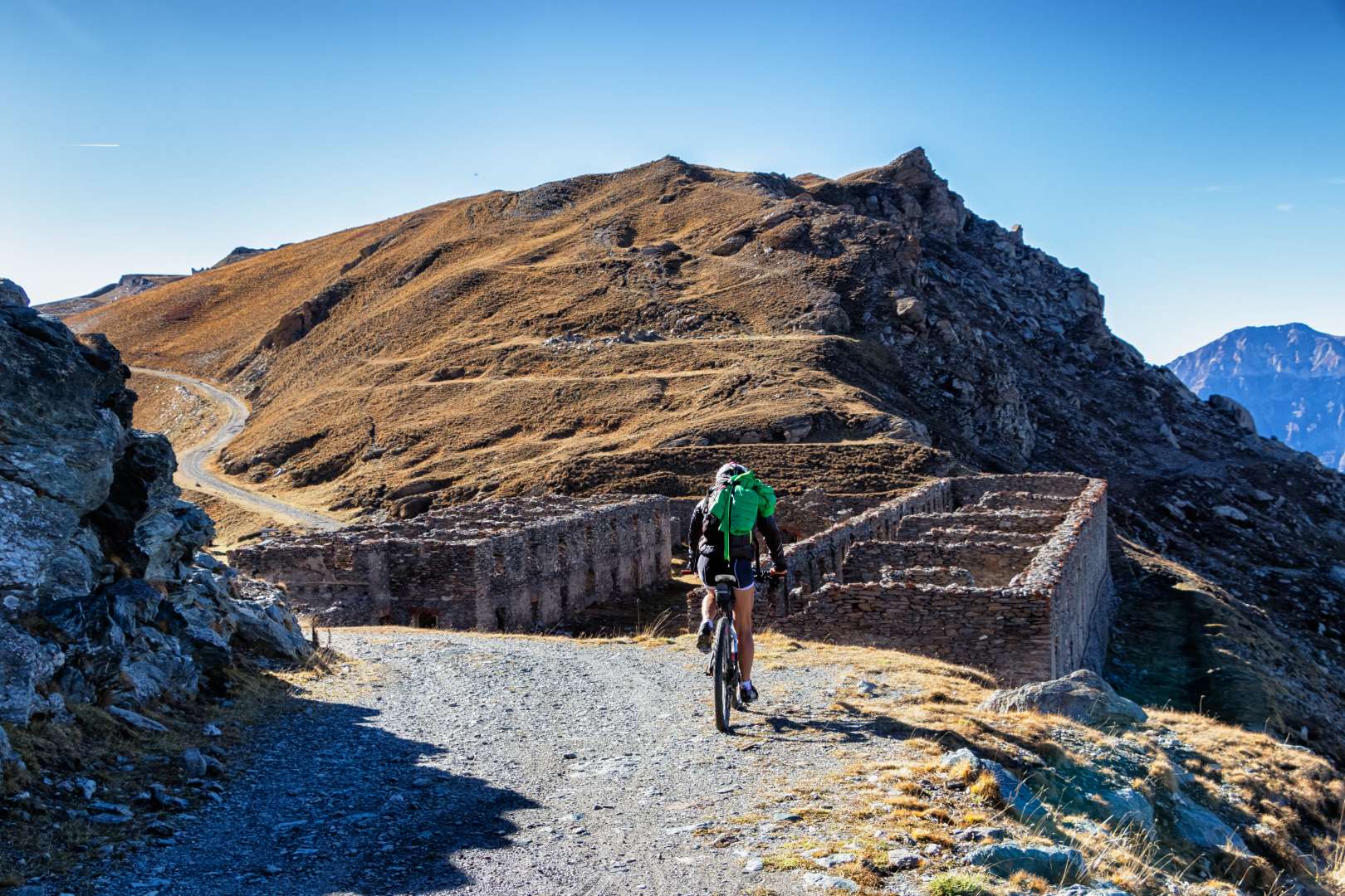
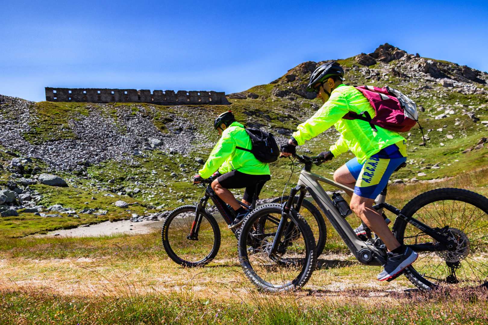
From Pian del Frais to reach the Barracks and then the Gran Serin Battery you have to travel about 11 km for an elevation gain of 1,150 m; with average gradient is 9%., the access is recognizable by the presence of a portal of the Assietta Road.
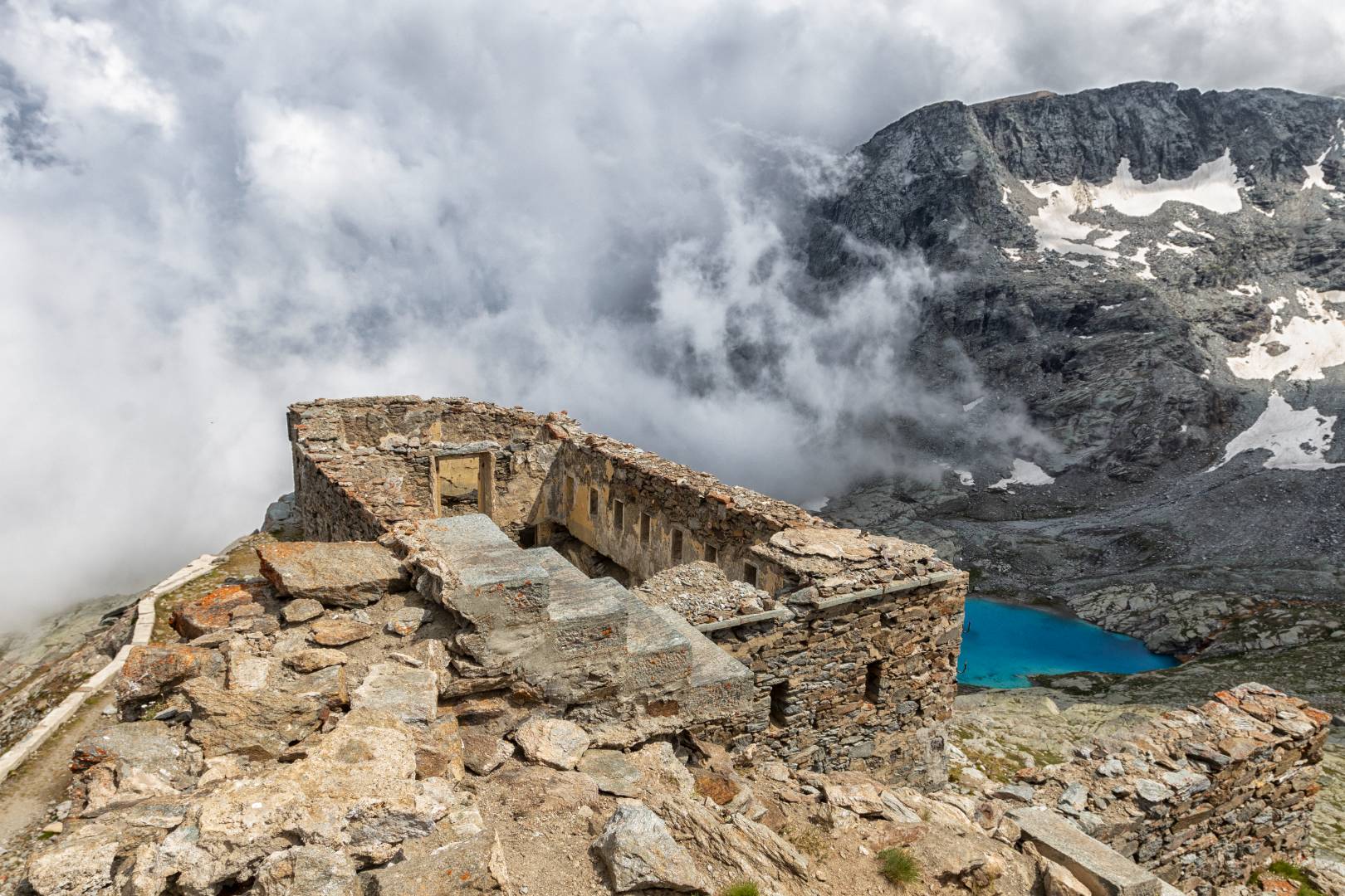
La Barracks, built in 1890 on the hill at an elevation of 2,540 m. included a building with stables and warehouses and the barracks proper, protected by a dry moat, which housed quarters for 800 men and infirmary; the Battery, instead was built 7 years later at the top of the mountain, at an elevation of 2,589 m. and was armed with two lines of artillery, to the west and east, firing docks for riflemen, defensive walls and a powder magazine behind the battery, reached by underground tunnel.
After the Arguel Pasture, the road begins to climb up through pastures with a series of long hairpin bends , until it turns with an elbow bend toward the plateau below the Barracks, with the small lake and on the knoll above the ruins remains of the optical station. With another couple of ramps and a hairpin bend, the junction of the military road from the Colle delle Finestre and the Gran Serin Barracks is reached. From here, if you wish, in 3.5 km you can reach the Assietta Pass and the road of the same name.
The accesses to the Assietta-Gran Serin ridge via Pian del Frais from the valley floor are three:
which departs from the Bastia/Essimonte hamlets and for the first 2.5 km or so is paved.
The road was laid out to reach the former ski resort at Pian Gelassa
Which starts behind the town’s train station
which starts from SS.24 just past the village and winds through the hamlets Coudissard and Clot Paquet and joins the Frais via Via Clot Rousset
These three roads at different heights are interconnected with each other
For those with legs (or sufficient batteries), Pian del Frais can be reached directly from Susa almost all by dirt road, via Bastia, and then Devejs di Gravere, using a wide, natural-bottomed road for a large part. Alternatively reach it using a tranfer or your own vehicle.
Alternatively, you can also proceed as far as Colle Assietta (a small climb and about 3 km downhill, and from there turn left always downhill to reach Pian dell’Alpe and return to Susa via Colle delle Finestre. But an ascent of an additional 250 m D+ must be factored in.