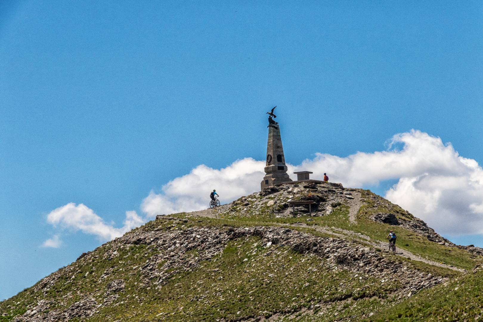
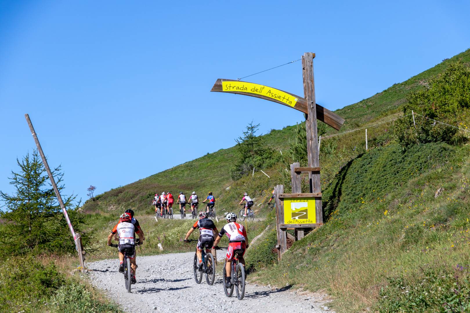
The Assietta Road is’ the most famous military road in the Western Alps and is the highest military route in Europe, touching an altitude of 2,550m. At the Assietta Head. It features numerous fortifications along its route that date back to different historical periods and is a veritable open-air museum of the history of mountain fortifications.
It is the main attraction among the former military and natural-bottom roads in the Susa and Chisone Valleys along with the Colle delle Finestre section.
The Road was built on the watershed of the ridges between Val di Susa and Chisone, which was the scene of the historic Battle of the same name on July 19, 1747, in which the Savoy troops in clear numerical inferiority (7,500 men partly also local volunteers against more than 20.000 armed, inflicting losses of over 5,000 men against 219 Piedmontese dead and wounded) blocked and defeated the French invader determined to conquer Piedmont by inflicting extraordinary losses, including their Commander General Fouquet de Belle-Isle. This Battle is remembered each year with a historical reenactment, and the date is Piedmont’s historic anniversary.
The nineteenth-century layout, which was remodeled several times until before World War II, is the heart of a system of fortifications and roads that run a total of more than 100 kilometers down the slopes and fit not into a unique panoramic setting overlooking the Western Alps, with views even of the nearby French 4,000.
The original nineteenth-century military road ran from the Colle delle Finestre, reached from both the Susa Valley and Chisone Valley sides, to the Colle dell’Assietta via the Fort and the Gran Serin Barracks, crest to crest.
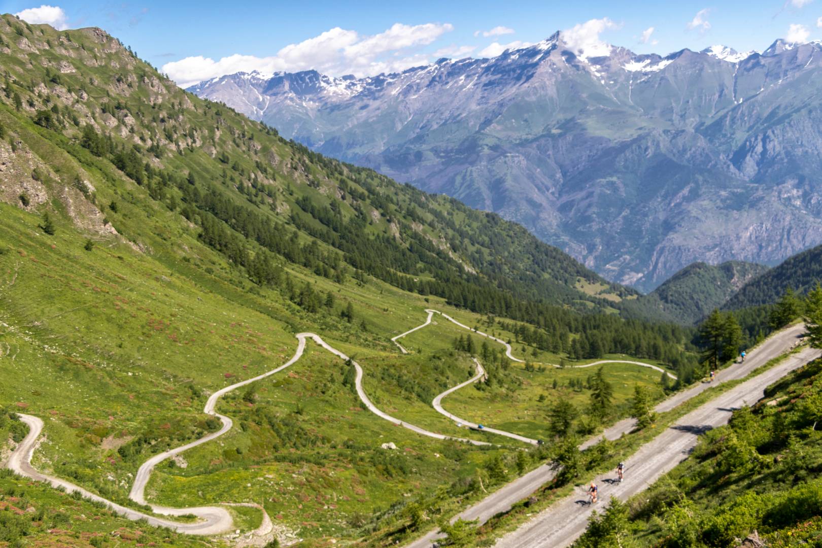
The heart of this system is provided by the current SP 173 of the Assietta, approximately 36 kilometers starting from the Pian dell’Alpe, in the territory of Usseaux in Val Chisone-recognized among the most beautiful villages in Italy-that reaches the slopes of Fraiteve after about 30 kilometers and then descends to Sestriere. This track was almost entirely built from scratch in the late 1930s.
It would be more correct to speak of System of Military Roads of the Assietta, 95 Kilometers of total development, rising to more than 130 Kilometers if you include the mule tracks, now partly converted to municipal and provincial secondary roads, and partly to hiking trails. With the stipulation of the Triple Alliance, the Defense Commission, for the watershed ridge between the Susa and Chisone Valleys, established to create the Assietta Military Square, a huge entrenched camp equipped with autonomous organization, barrages and fortifications, supplemented in the valley by the Fenestrelle and Exilles Forts and the Susa barracks.
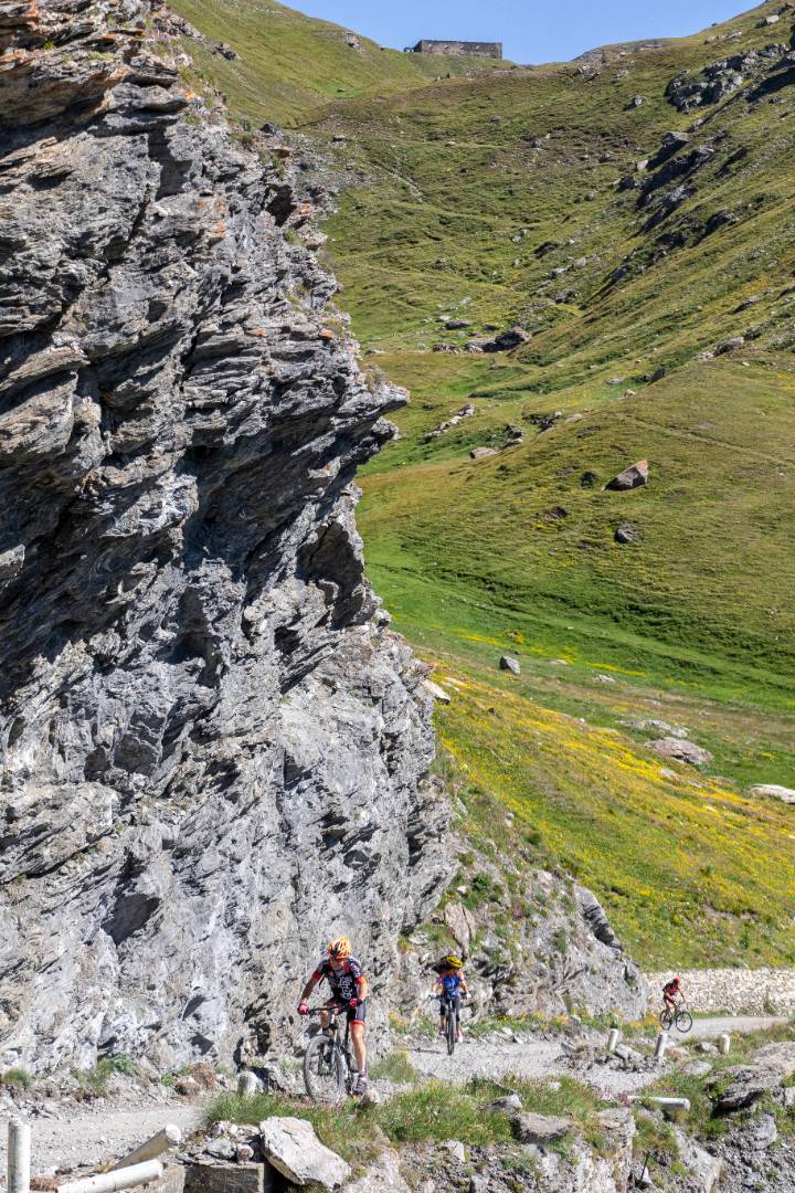
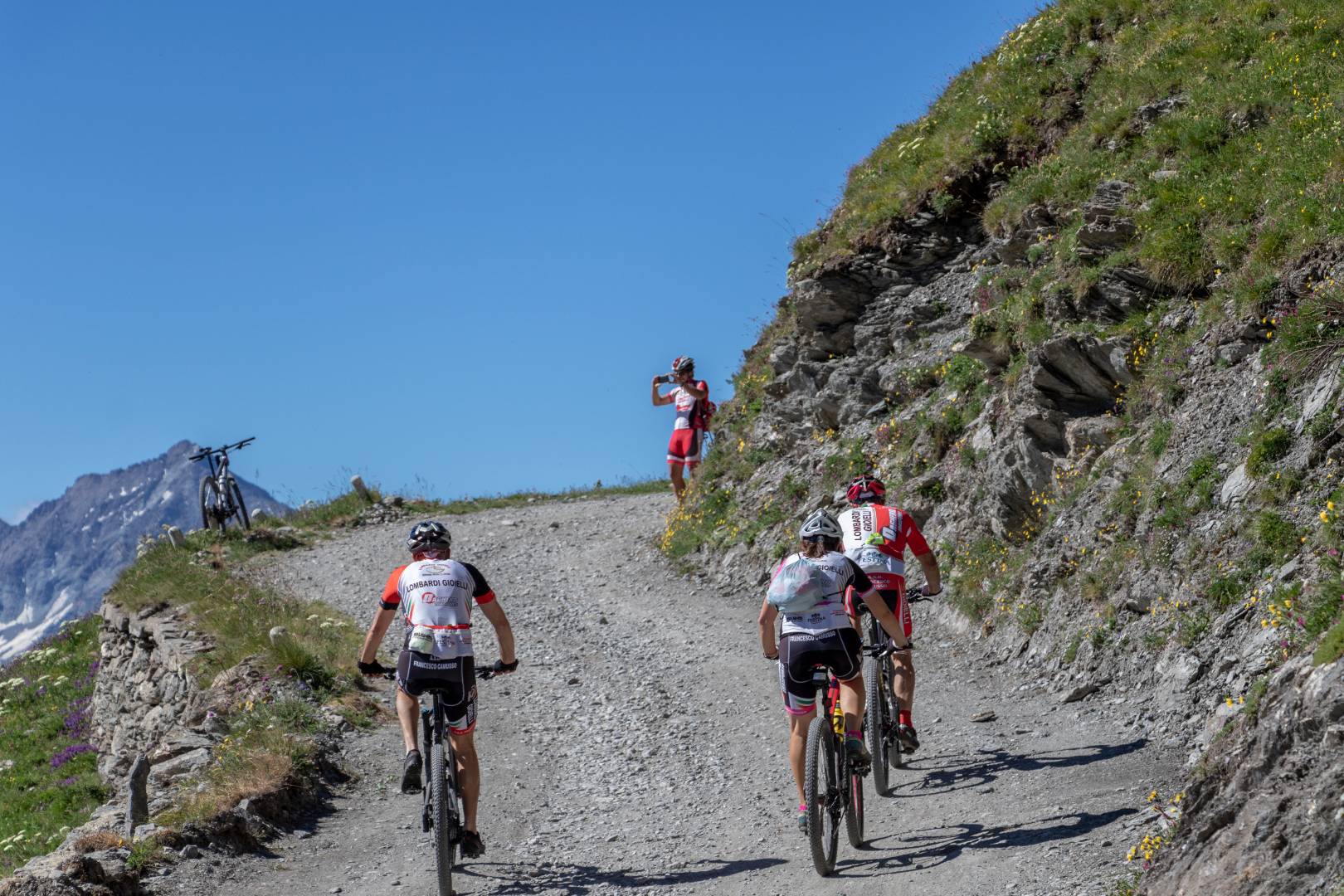
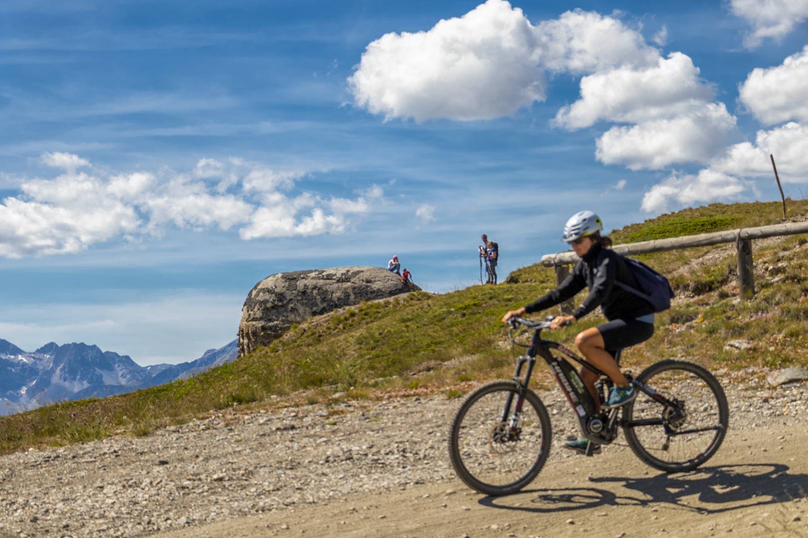
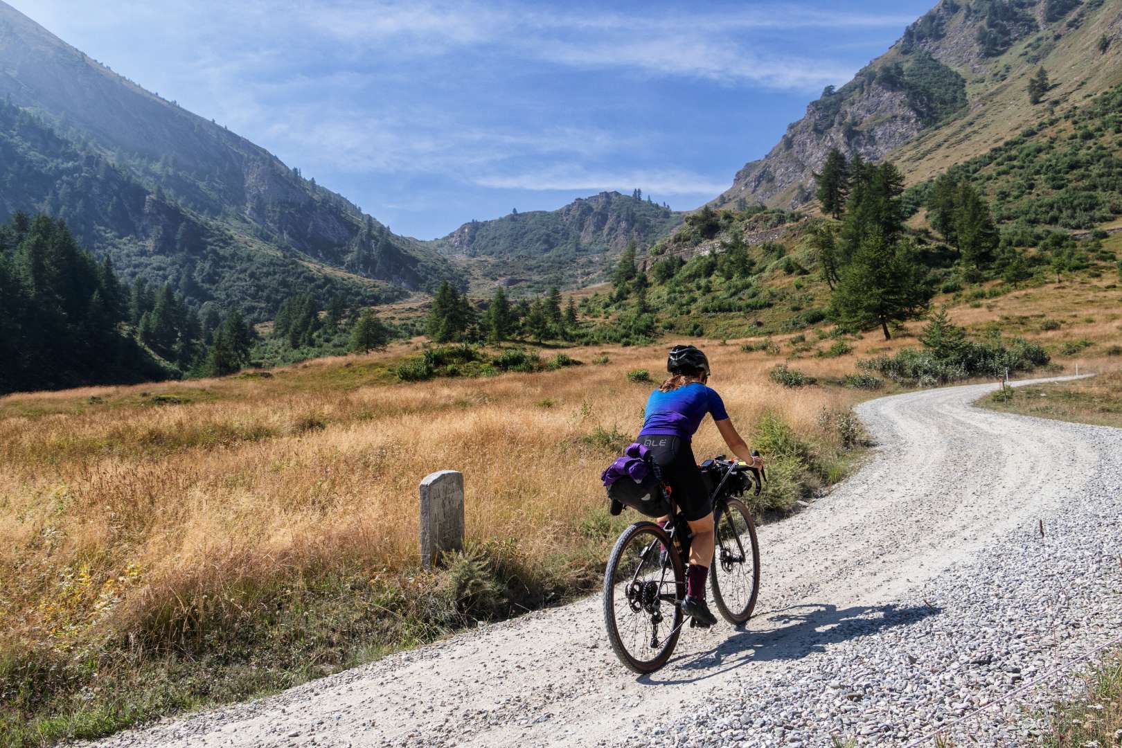
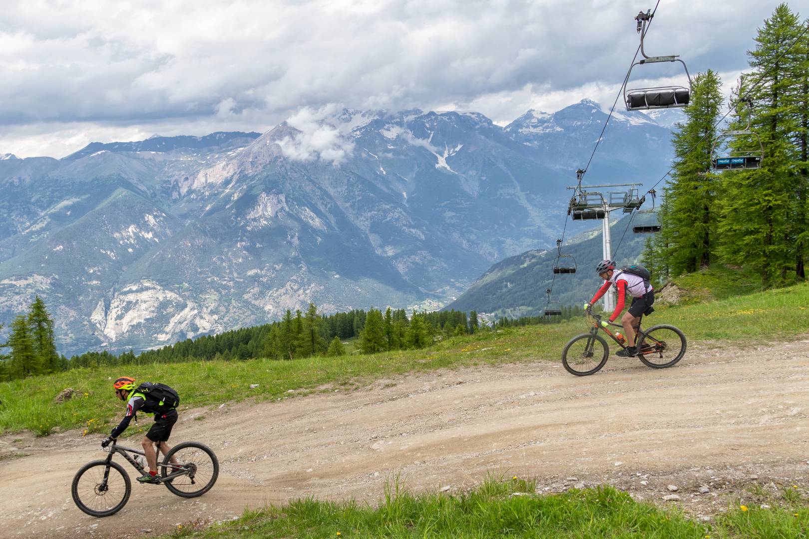
Work began in 1889 with the creation of the network of military roads all still usable, which was, completed in only 4 four seasons of work! Today, a true MTB paradise, but one that requires excellent training, some of which can be overcome with the help of E-MTBs.
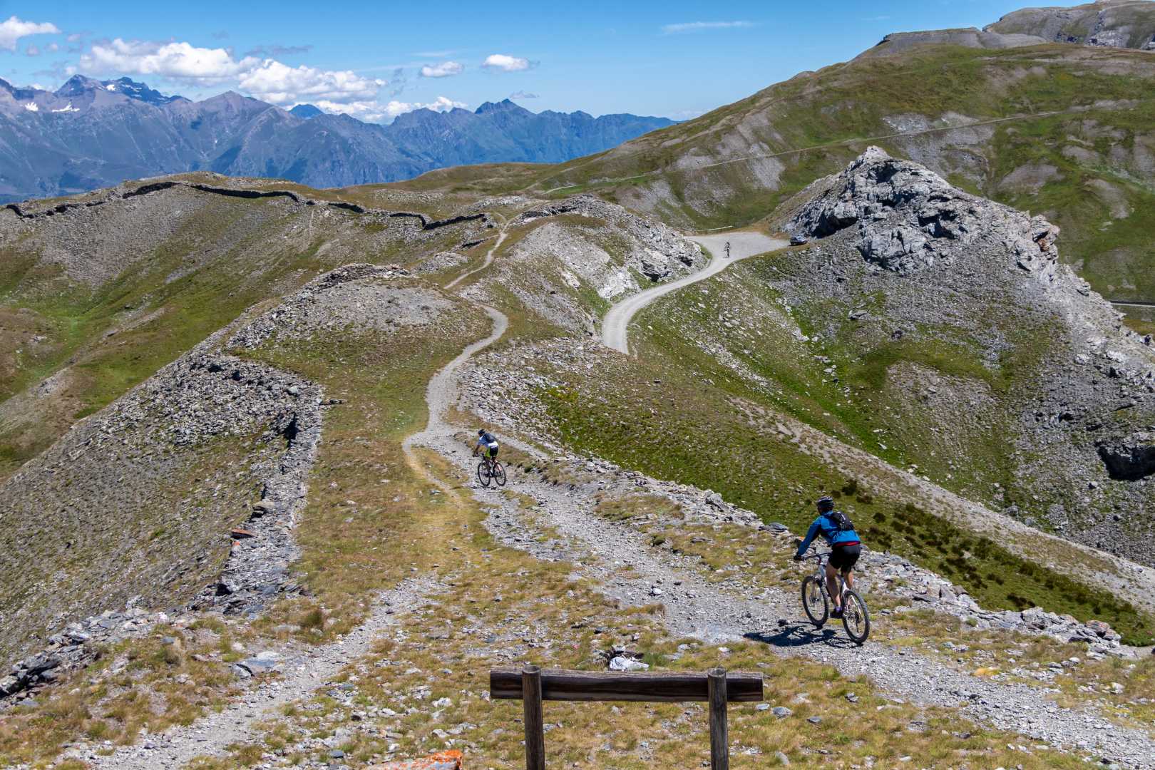
The ridge trail runs almost entirely above 2,000 m. passing at the foot of Cima Ciantiplagna (2,849 m), Punta Vallette (2,743 m), Gran Pelà (2,692 m) and Punta del Gran Serin (2,629 m) thus arriving at Assietta Pass (2,474 m.). Afterwards it continues a little on the Chisone Valley side and a little on the Susa Valley side and crosses the following hills in order: Colle Lauson, Colle Blegier (2,381 m.), Colle Costa Piana (2,313 m.), Colle Bourget (2,299 m.) and the Colle Basset (2,424 m.). It also passes under the following mountains: Testa dell’Assietta (2,566 m.), Testa di Mottas (2,547 m.), Monte Gran Costa (2,615 m.), Monte Blegier (2,585 m.), Monte Genevris (2,533 m.), Monte Triplex (2,507 m.) and Monte Fraiteve (2,701 m.).
The road is generally accessible during June – November 1 according to snow conditions and subject to regulation:
In July and August, on the other hand, there is a closure to motorized traffic on Wednesdays and Saturdays from 9 a.m. to 5 p.m. from Pian dell’Alpe to Col Basset, as well as for access/egress from Sestriere and Sauze d’Oulx.
The Road of the Hill of Windows
Today SP. 172, a connects Susa, through Meana di Susa to the Colle delle Finestre and continues into Val Chisone via the Fort of Fenestrelle. It has a development of 18.7 kilometers, an elevation gain of 1,692 meters with an average gradient of 9% with a total of 33 hairpin bends, 24 of which are very narrow masonry hairpin bends, Colletto di Meana (elevation 1,452) to Colle (elevation 2,178) still dirt road for the final 8 kilometers..
The Colle delle Finestre hill climb with its dirt road has entered since 2005 (when it was first included in the Giro d’Italia, then followed by 2011 and 2015, Stages all with arrival at Sestriere) in the list of the Great Ascents of the Procycling professional circuit, but to consecrate it definitively in the absolute myth was Chris Froome on May 25, 2018, who in the 19th Stage Venaria Reale-Jafferau right on the Col gave birth at the very beginning of the dirt road to a breakaway and a feat of old-fashioned cycling: 82 km in a solo breakaway, with epic detachments to the other competitors as had not happened in years
The Hill, among the Coppi Peaks of the Giro and in the Colli Hors Catégorie of world cycling has definitely entered the cycling myth thanks to the British athlete and attracts road cyclists on its dirt hairpin bends.
The descent to Usseaux and Val Chisone is partly paved except in the section of Pian dell’Alpe from which turning east you reach by the continuation of the road the Forte Di Fenestrelle and continuing west you begin the Assietta Road.
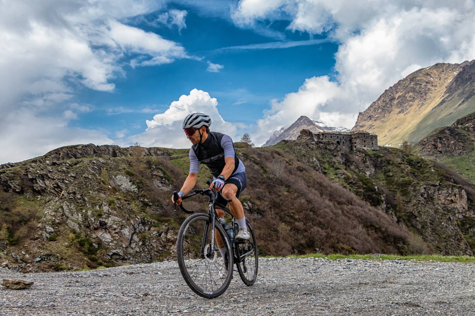
At the top of the watershed is the Fort Del Colle Delle Finestre which dominates the Valley below and the road up to the Colletto and was built in the shelter of the rock face overlooking the Colle delle Finestre in the municipality of Meana di Sua as a support work for the other forts of the Fenestrelle and Assietta strongholds. Its defiladed position protected it completely from view from the Chisone Valley side while allowing its concealed cannons to operate.
The Meana-Colle Finestre-Dépot was built by the Military Commands of the Kingdom of Italy in 1890 for the purpose of allowing rapid movement of troops between the Chisone and Susa Valleys. The project, carried out in 1889, was studied by the Army Corps of Engineers. The greatest difficulty was to tackle the steep slope leading from the hamlets of Meana to the Colletto, an obligatory point of passage.
We propose the complete itinerary with the descent from Col Basset on Sauze d’Oulx, and then Oulx, remembering that it is possible to create loop routes by anticipating the descent into Susa Valley from Gran Serin on Pian del Frais and then to Chiomonte and Susa, or on Salbertrand / Sauze d’Oulx via Monfol from Colle Blegier via another branch of military roads all perfectly cyclable.
In all these cases for the return to Susa, it is possible to make use of the train via lineSFM3, or the historic Turin-Bardonecchia line, getting off at Meana di Susa to return to the starting point.
Battery recharging is also possible for small groups at some points along the route (Pian dell’Alpe Farmhouses, Alpe Assietta, Casa Assietta Refuge).